Pelican Valley Guided Backpacking Trips

Pelican Valley to The Lamar Valley & The Lamar River Trail
Northeast Yellowstone - 4 Days/3 Nights
Dates: Aug 18th-21st
Tour Price: $1,450 per person
Experience two of Yellowstone's premier wildlife habitats and tie them together with a beautiful four day trek along the famed Lamar River. Witness herds of bison grazing across these broad valleys, keep a watchful eye for wolves and grizzlies, and immerse yourself in the history of one of Yellowstone's most iconic locations, the Lamar Valley. It's here that the first efforts to preserve and restore the bison were carried out and it's here that we can see and experience the success of those efforts firsthand.
Click any image below to open a slide show.


Pelican Valley Overview
The Pelican Valley & The Lamar Valley Guided Backpacking Trip
Pricing: $1,450 per person
Length: 4 Days/3 Nights
Distance: 32.1 mi/51.6 km
Trip Type: Guided Backpacking
Average Elevations: 6,500-8,000 ft/1,981-2,438 m
Maximum Elevation: 8,790 ft/2,679 m
Location: Northern Yellowstone
When to Visit: July-Early September
Difficulty: Easy to Moderate
Route: Point-to-point
Group Size: 2-8 people
Age Limit: 16+
Scenery: Broad Valleys, High Mountains and the Lamar River!
Potential Wildlife: Elk, Bison, Moose, Black Bear, Grizzly Bears and Wolves.
QUESTIONS? CALL: +1-406-595-1823
2025 Trip Dates & Pricing
Price includes equipment rentals and backcountry meals and snacks. See the "General Information" section below for additional details.
| Dates | Pricing Per Person |
|---|---|
| Aug 18-21 | $1,450 |
Pelican Valley Itinerary
Day 1: Easy to Moderate - 11 mi/17.7 km
Our trip begins in Bozeman, Montana with a departure time of 5am. The drive to the Pelican Valley Trailhead (5K3) will take approximately 3-3.5 hours. Our starting point for the trip is located at the north end of Yellowstone Lake on the very east side of the park. During the shuttle ride we'll make stops in Gardiner, Montana, Mammoth Hot Springs and Canyon Village as needed. There will be plenty of breakfast foods and beverages available for our early morning commute.
After arriving at the Pelican Valley Trailhead (5K3) we'll double check our equipment and discuss the rules and regulations for hiking in this particular area. Throughout Yellowstone National Park biologist have set aside certain locations that are prime habitats for bears and other wildlife. These regions are known as "bear management areas" or simply "BMA's." The Pelican Valley BMA provides a rare opportunity to see grizzlies, wolves, bison and elk and therefore certain restrictions are in place to minimize human interactions. The Pelican Valley is closed from April 1st through July 3rd. On July 4th hikers and backpackers are allowed in the area between the hours of 9am and 7pm. There is no overnight camping in this region and so for us this simply means a longer hike of approximately 11 miles (17.7 km) on our first or last day depending on which direction we run the trip.
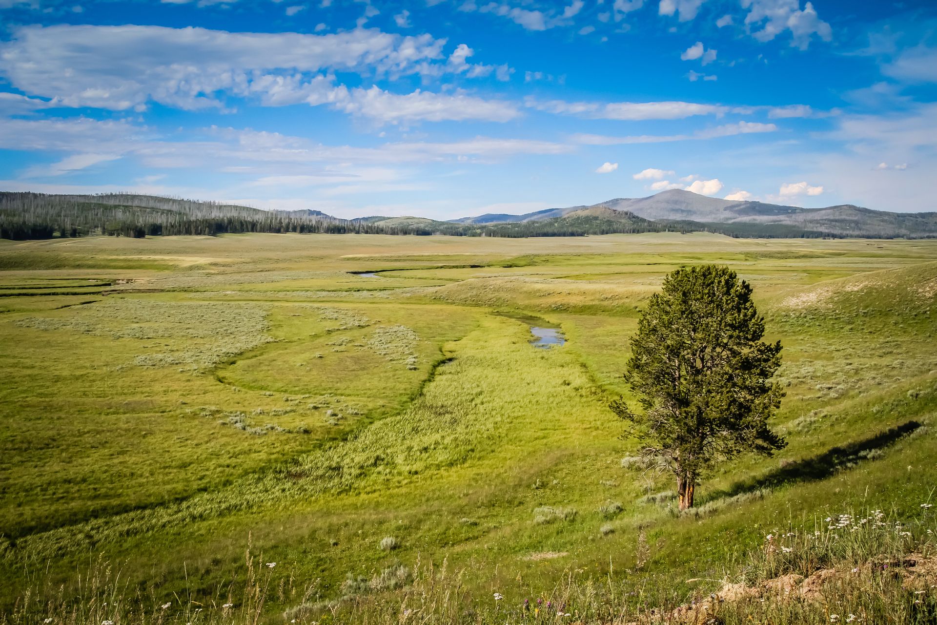
The initial hiking is relatively easy, passing through open meadows and the forested areas south of the main valley. After a few miles we exit the tree line where we get our first glimpse of the Pelican Valley, its rolling hills stretching far to the north. The slow moving waters of Pelican Creek meander in a series of broad loops that add countless miles to its relatively short journey to Yellowstone Lake. Passing the junction for Turbid Lake the trail turns north and travels along a well defined path, rising and falling over the valleys gentle terrain.
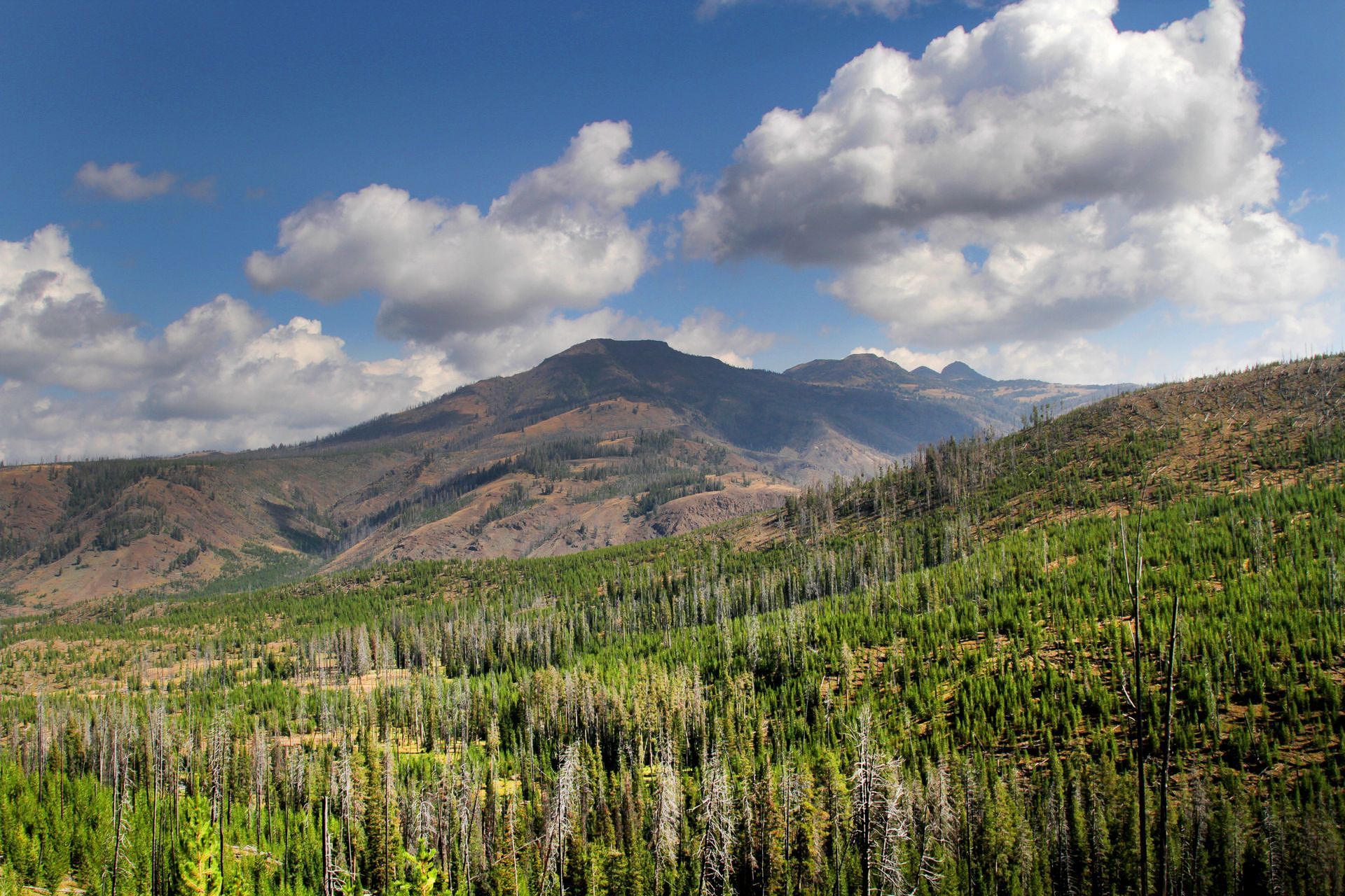
After a few miles the trail reaches the opposite end of the valley and the Pelican Springs Patrol Cabin. Like so many man-made structures in the park this small and inconspicuous log cabin is dwarfed by the surrounding landscape. From the ranger station we begin our gradual ascent to the top of Mist Creek Pass at 8,790 ft. (2,679 m) which climbs 800 ft. (243 m) to this high point. There are spectacular views across the entire length of the Pelican Valley to the northern shores of Yellowstone Lake. Nearing the top of the pass the landscape is dotted with large numbers of standing dead trees burned during the Clover-Mist fire. Much of the Yellowstone has been transformed by wildfires and during the summer of 1988 this area was ravaged by this massive wildfire.
On the descent from Mist Creek Pass the landscape remains very much the same and it's easy to spot the small valley where we will spend our first evening. After making camp and cooking a hearty dinner we can reminisce about our eventful first day in Yellowstone National Park.
Day 2: Easy - 7-10 mi/11-16 km
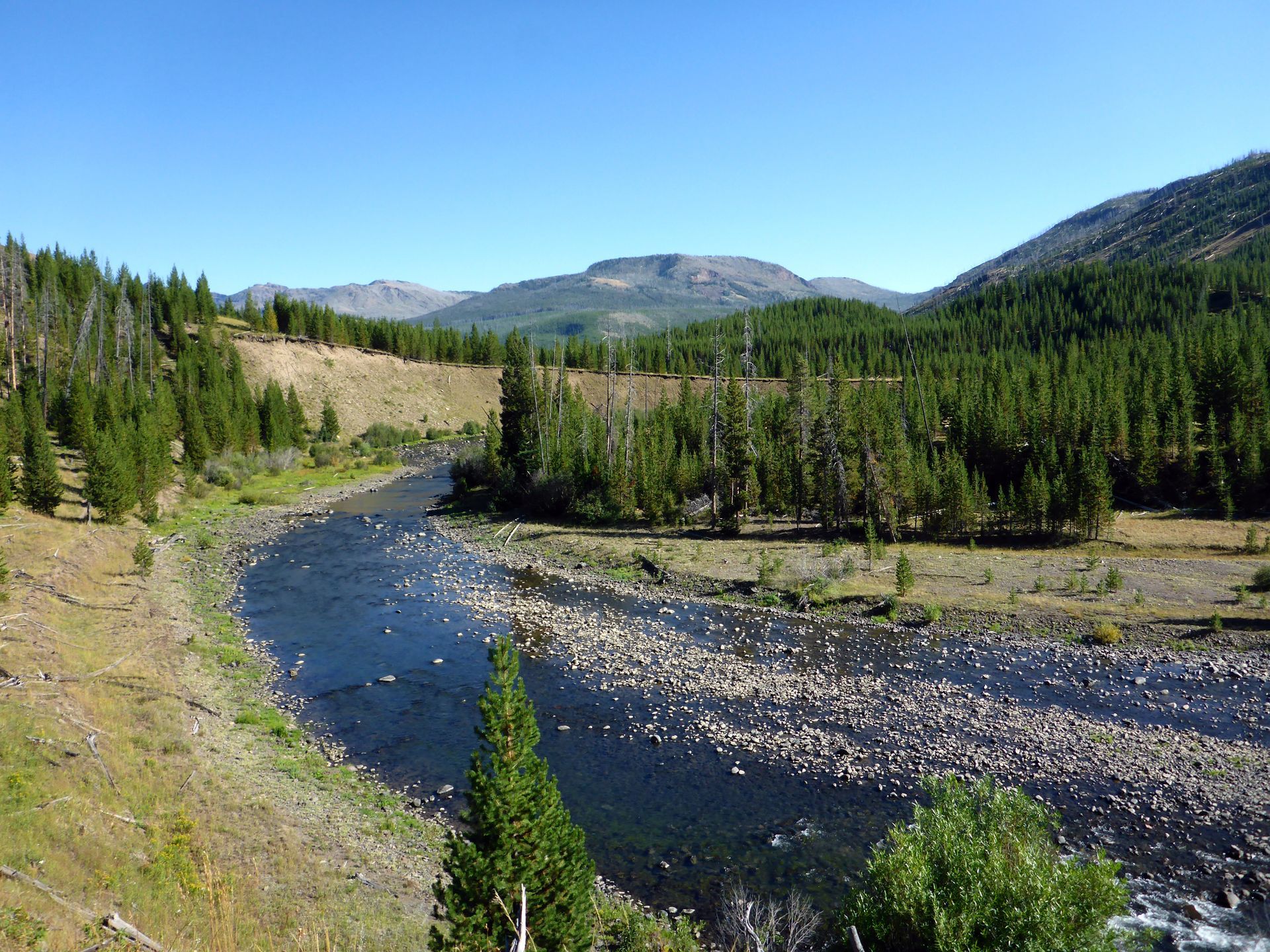
On day two we'll exit this valley and descend along Mist Creek at a gentle grade towards Cold Creek and the famed Lamar River. After fording Cold Creek we'll pass the Frost Lake Trail and then shortly there after we cross the Lamar River. The high peaks of the Absaroka Range that form the park's eastern boundary dominate the skyline, reaching heights of over 10,000 ft. (3,048 m). From this location we'll begin our sixteen mile trek along the Lamar River Trail as it follows one of Yellowstone's most iconic waterways. There are plenty of campsites to choose from throughout this area and most are located very close to the river. If you're an avid fly fisherman this blue-ribbon trout stream provides plenty of opportunities to fish for native trout.
Day 3:
Easy -
6-8 mi/9.6-12.8 km
On day three we continue hiking the Lamar River Trail over similar terrain, climbing and descending the low hills that flank the river. To the west a number of smaller creeks carve channels in the hillsides as they descend the slopes of the Mirror Plateau before emptying into the Lamar. Elk and moose wander those same hillsides browsing on the plentiful grasses and sedges. Outfitters travel this region as well, heading to the numerous stock sites along the trail, their horses plodding along single file, weighted down with all manner of food and equipment. It's a familiar sight and they look right at home in Yellowstone's backcountry.
Day 4: Easy - 6-8 mi/9.6-12.8 km
On our final day we head to the Lamar Valley! After fording Cache Creek the trail climbs about 250 ft. (76 m) to a hillside where we get our first glimpse into the valley below. Hiking these last few miles is a surreal experience and the sheer scale of the Lamar Valley is overwhelming. Large herds of bison roam these grasslands grazing on the seasonal bounty that will help sustain them through Yellowstone's long, harsh winters. Small groups of pronghorn lounge among the sagebrush keeping a watchful eye for predators. The majestic elk find higher ground above the valley floor but their presence is still evident. It's here that we find an abundance of wildlife, both predators and prey, easily visible in their natural environment. The Northern Range boasts the highest concentration of wildlife in the park and its an important place for grizzlies and wolves that depend on these animals to survive.
Before long we'll begin to notice the telltale signs of civilization as vehicles hurry along the park's Northeast Entrance Road. The parking lot at the trailhead is visible on a small bluff above Soda Butte Creek and it marks the end of another incredible Yellowstone adventure.
General Trip Information
Guest Reviews
Barbara S.
"Brian provided a great experience for us. We did a private 3 day backcountry hike with him and it was wonderful. He is very experienced, very friendly and very professional. All around once in a lifetime opportunity."