Cache Creek Guided Backpacking Trips

Cache Creek Trail via The Lamar Valley
Northeast Yellowstone - 4 Days/3 Nights
2026 Dates: Aug 10th-13th
Tour Price: $1,400 per person
Difficulty: Moderate to Difficult
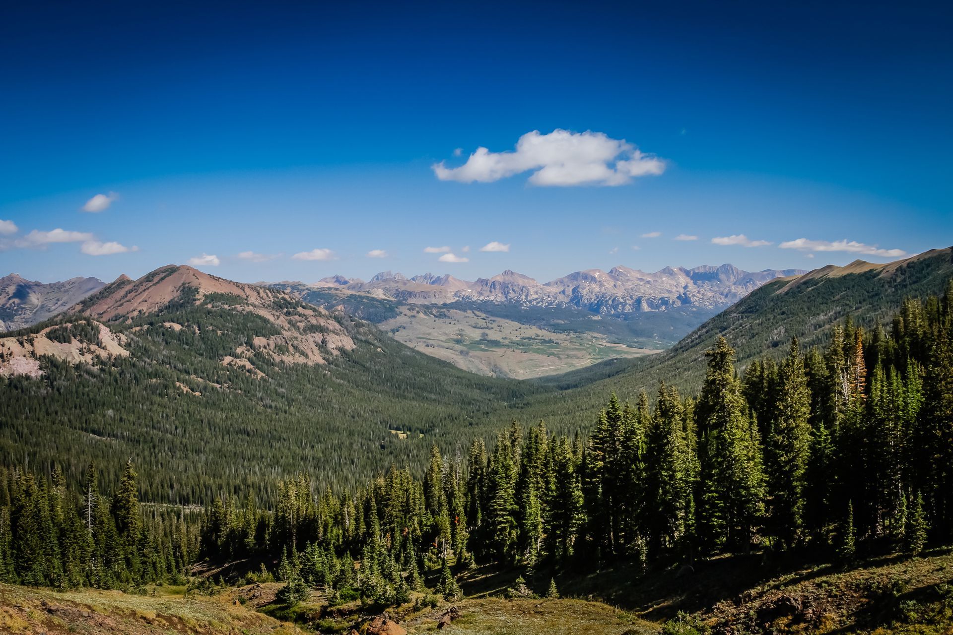
From the wide open spaces of the Lamar Valley to the windswept summit of Republic Pass, this four day guided trek has always been a guide favorite. Hiking through this glacial valley takes us into one of Yellowstone's more mountainous regions where the surrounding peaks provide stunning backdrops at every turn. A visit to Republic Pass is an unforgettable experience that offers breathtaking views that extend far beyond Yellowstone's borders and into the surrounding national forests. It's a must-see destination that will take you well off the beaten path.
Click any image below to open a slide show.

Cache Creek Overview
Cache Creek Guided Backpacking Trip - Aug 10-13, 2026
Pricing: $1,400 per person
Length: 4 Days/3 Nights
Distance: 29.7 mi/47.7 km
Trip Type: Guided Backpacking
Average Elevations: 7,000-8,000 ft/2,133-2,438 m
Maximum Elevation: 9,957 ft/3,034 m
Location: Northeast Yellowstone
When to Visit: July-Early September
Difficulty: Moderate to Difficult
Route: Point-to-point
Group Size: 2-8 people
Age Limit: 14+
Scenery: Lamar Valley, Beautiful Mountain Streams, Mountain Scenery, Republic Pass!
Potential Wildlife: Bison, Moose, Elk, Black Bear, Grizzly Bears and Pronghorn.
QUESTIONS? CALL: +1-406-595-1823
2026 Trip Dates & Pricing
Price includes equipment rentals and backcountry meals and snacks. See the "General Information" section below for additional details.
| Dates | Pricing Per Person |
|---|---|
| Aug 10-13 | $1,400 |
Cache Creek Itinerary
Day 1: Easy - 8.6 mi/13.8 km
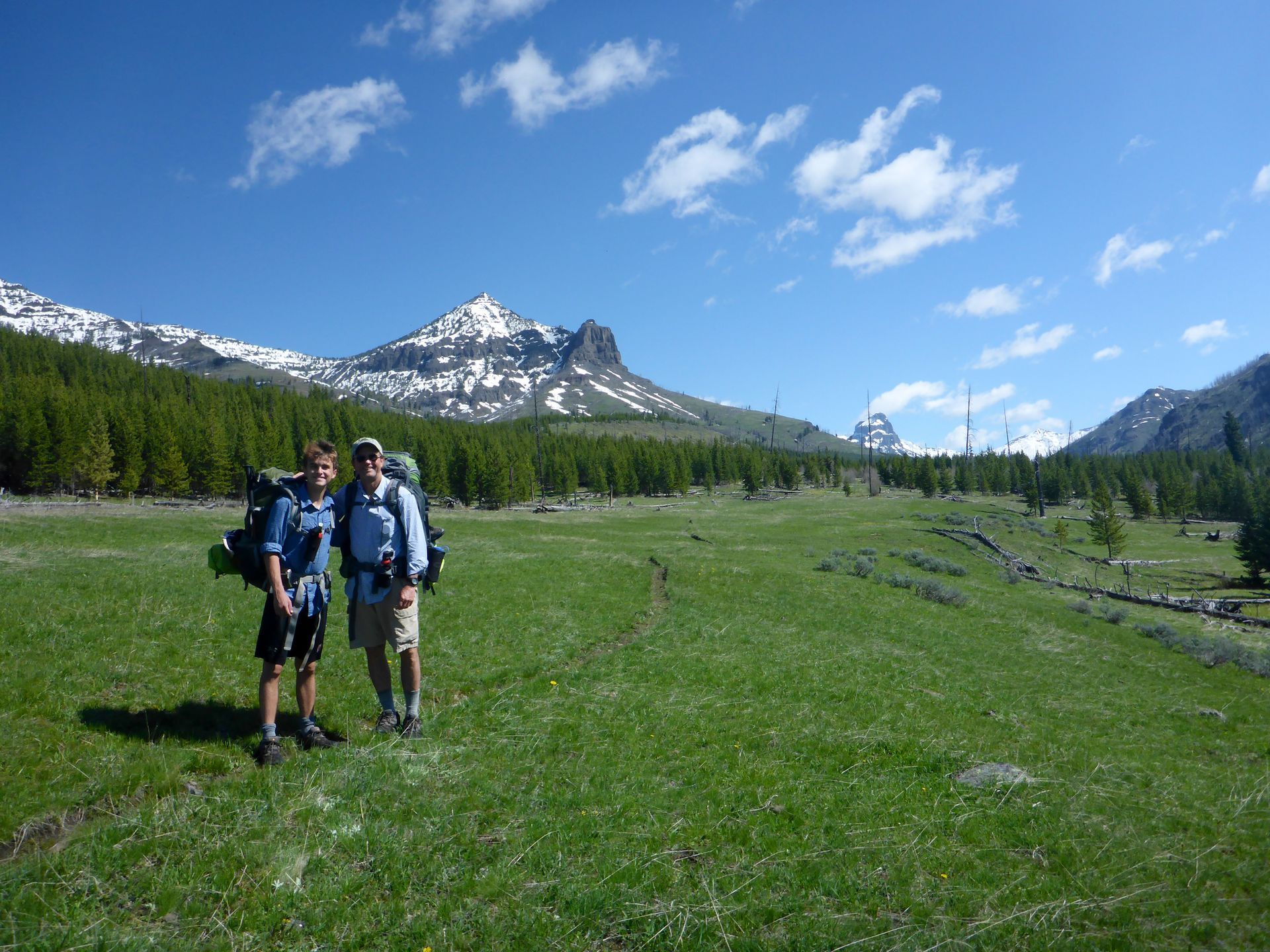
On our first day we have a 3 hour drive from Bozeman, Montana to the trailhead in the Lamar Valley. After entering the park near Gardiner, Montana we'll head south to Mammoth Hot Springs before traversing the park on the Northeast Entrance Road.
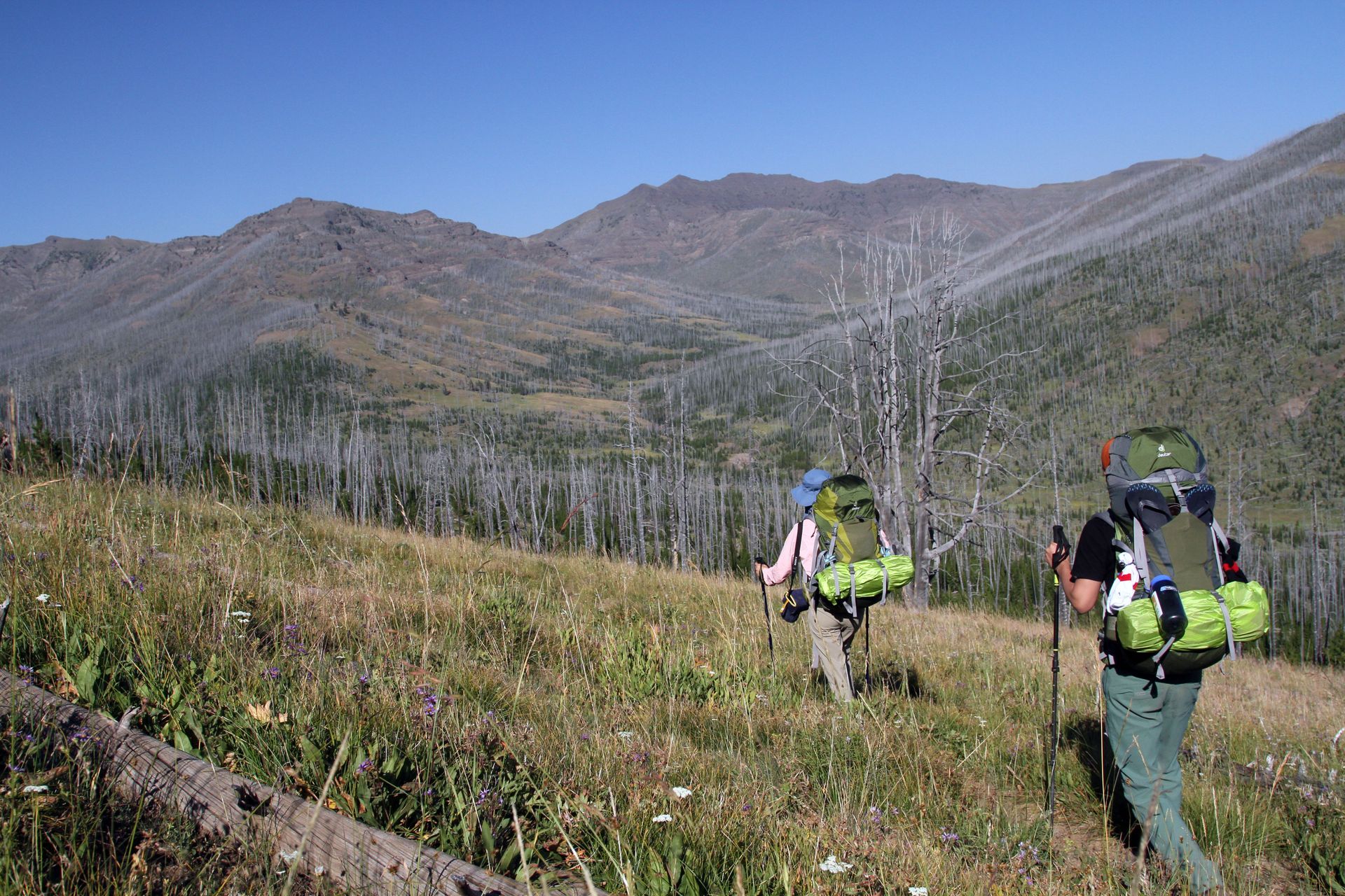
From the moment you set foot in the Lamar Valley you'll be treated to the awe-inspiring landscapes and the incredible wildlife of Yellowstone's Northern Range. This area is often referred to as the "American Serengeti" and is one of Yellowstone's premier wildlife habitats. It's the best place to see bison, wolves, pronghorn and the mighty grizzly bear. We'll be following its eastern edge via the Lamar River Trail.
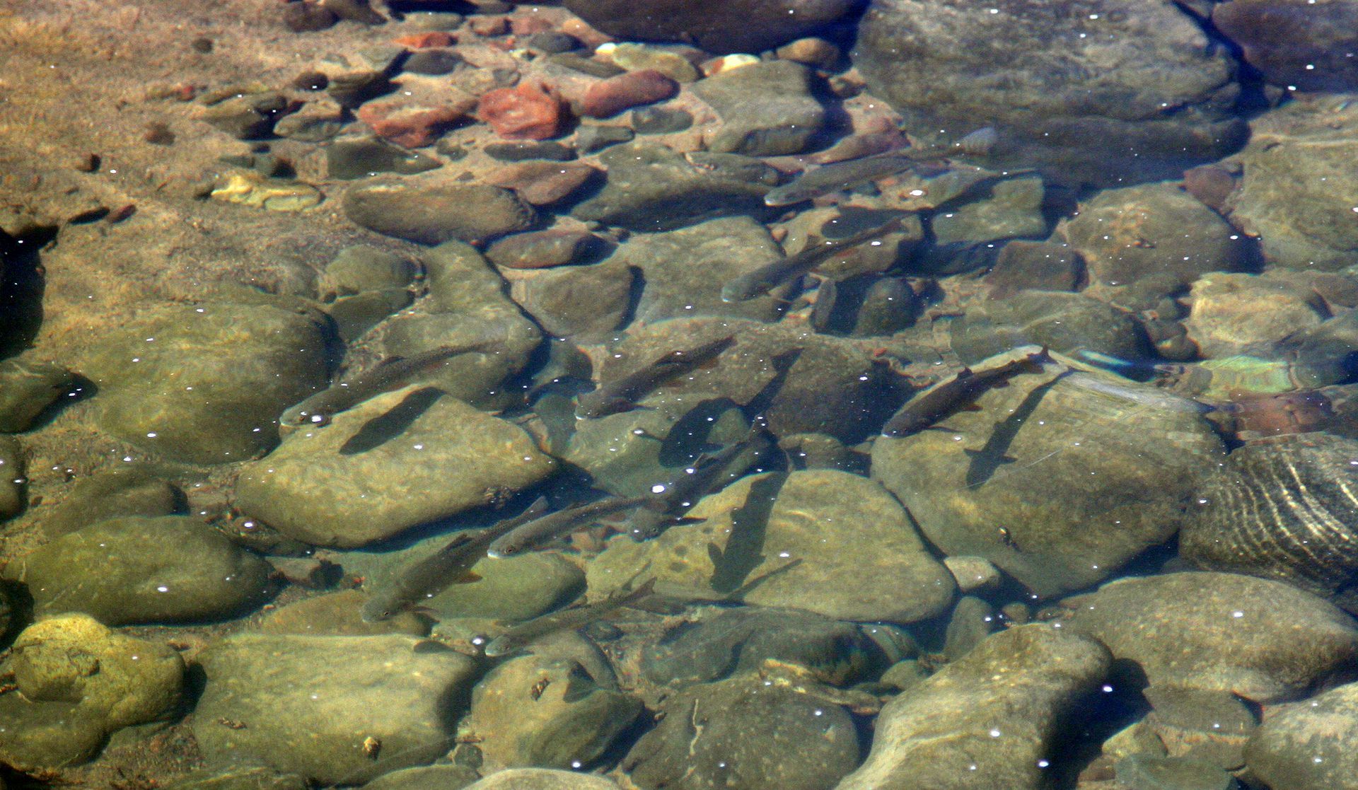
After a spectacular hike through the Lamar Valley we'll join the Cache Creek Trail and begin our trek northward along this pristine waterway. Directly to the west the towering peaks of Mount Norris and The Thunderer rise to over 9,000 ft. (2,743 m), and looking further north we see evidence of how this region has been shaped by glaciers thousands of years ago. Our first campsite provides exceptional views up and down the valley and is situated close to Cache Creek. After dinner our guests can fish for native trout or simply relax beside this small but beautiful mountain stream and if we're lucky we may see signs of moose, bison and elk that roam this isolated valley.
Day 2: Easy - 6.5 mi/10.4 km
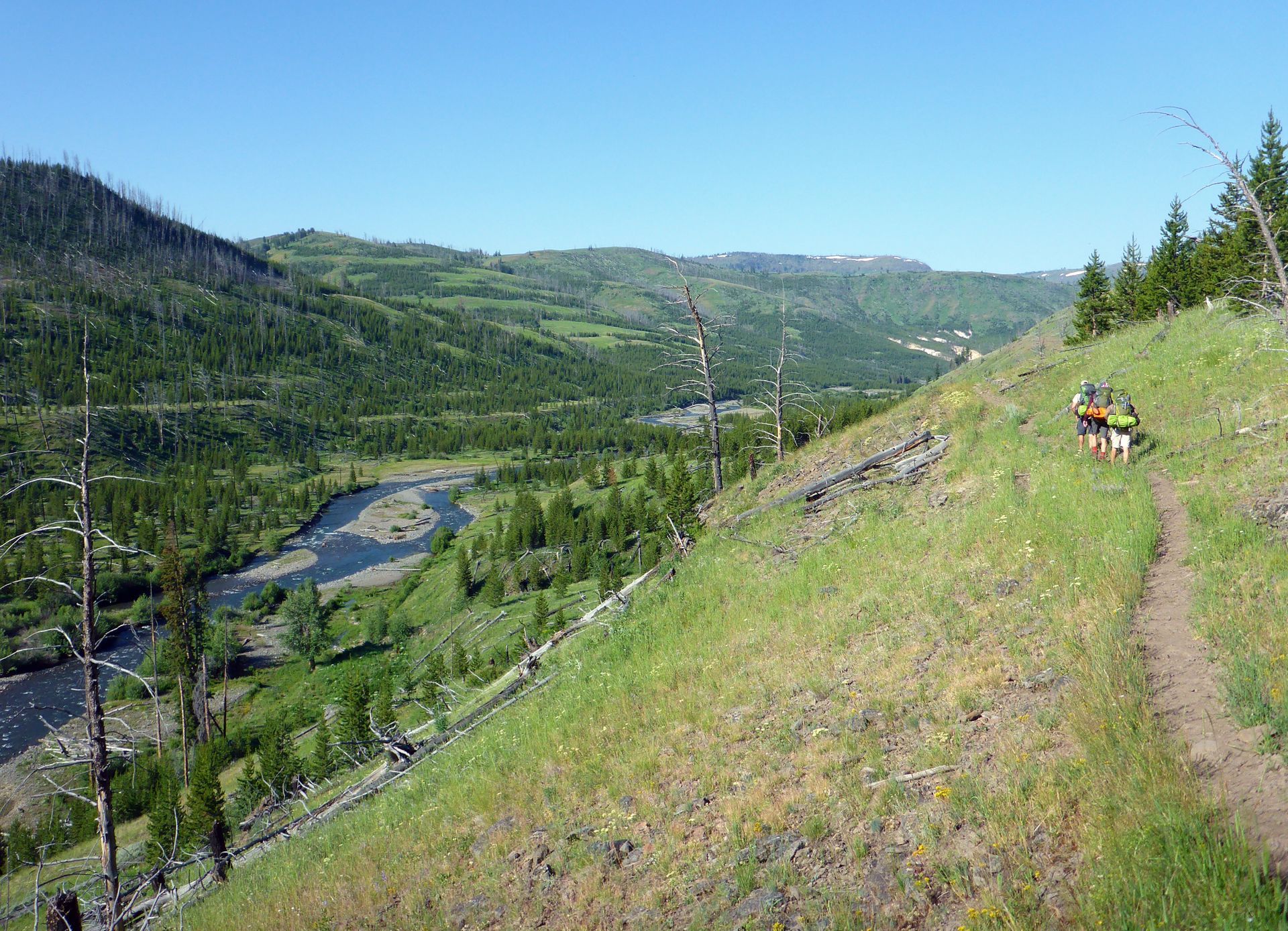
On day two we continue heading north through a patchwork of new forests and lush meadows impacted by previous wildfire activity. In 1998 the Clover-Mist fire burned a significant portion of the park in this area and its effects can still be seen to this day. At mile thirteen we approach The Thunderer Cutoff Trail and the Cache Creek Patrol Cabin. This tiny backcountry outpost provides a nice spot to rest and is dwarfed by the high mountain peaks that dominate the skylines of northeast Yellowstone. After leaving the cabin we cross Cache Creek and head east to our designated campsite for the evening. Here we can relax in preparation for our day hike to the top of Republic Pass the following morning.
Day 3: Moderate to Difficult -
9 mi/14.4 km
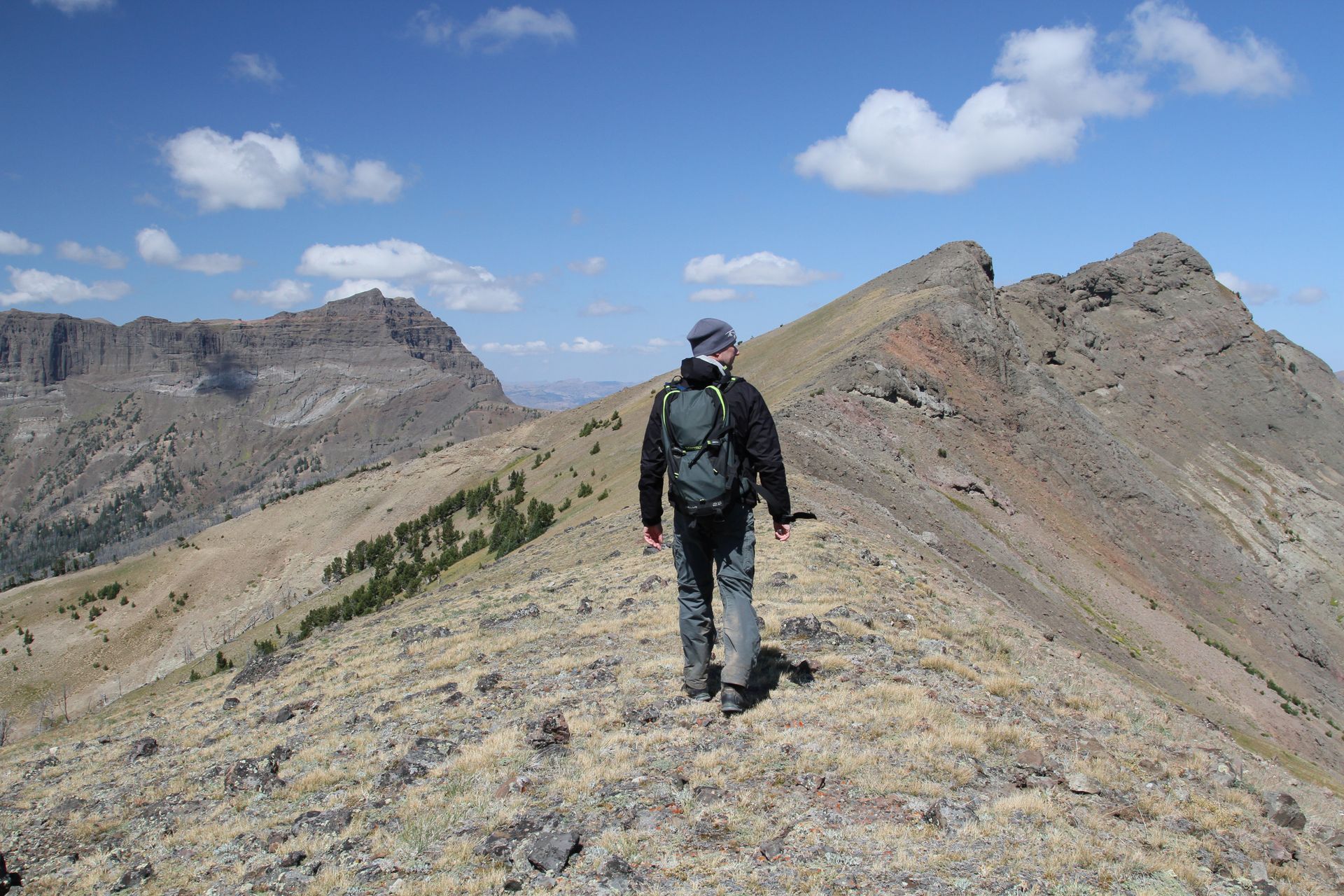
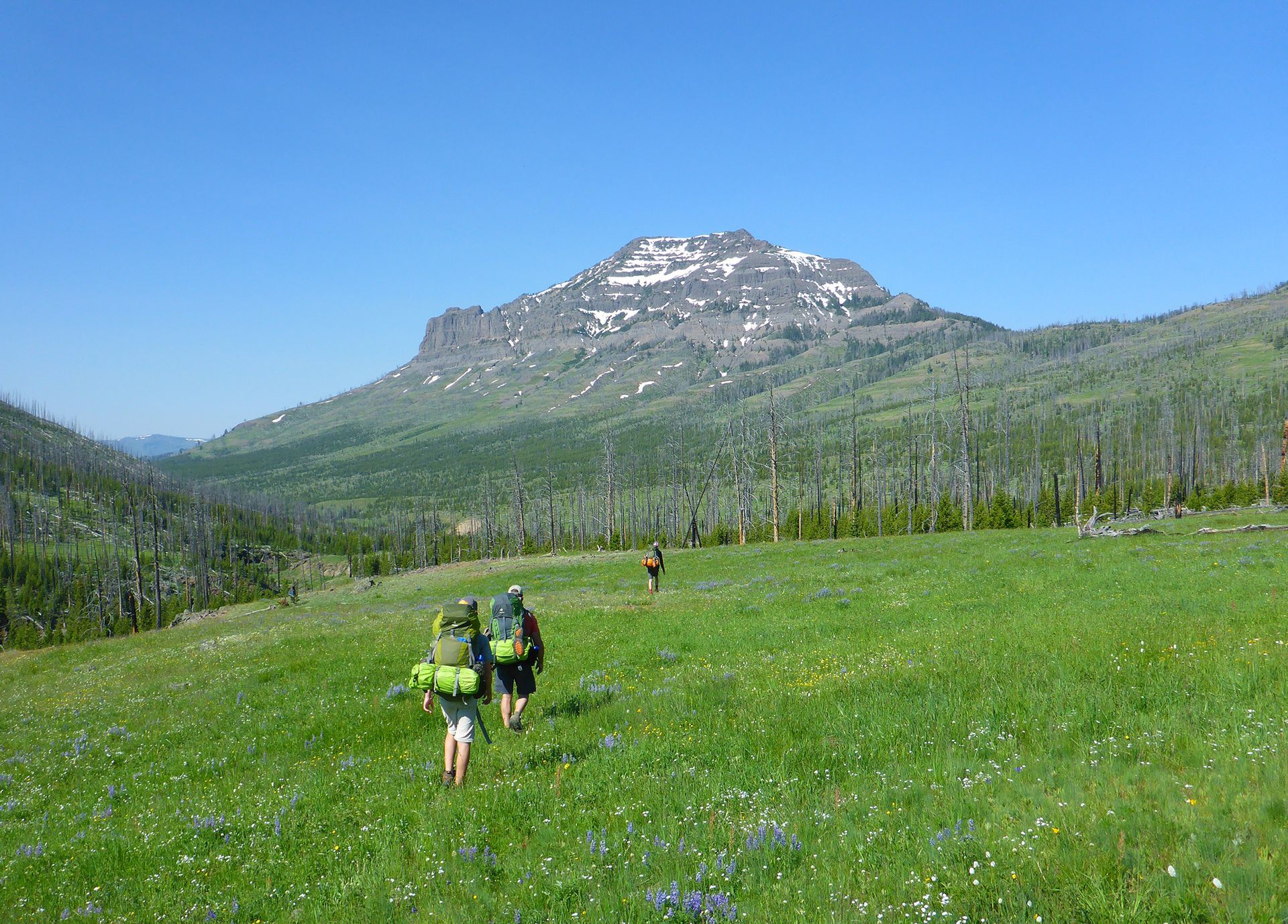
After an early breakfast we'll leave camp—weather permitting—and begin the ascent to the crest of Republic Pass (9,957 ft. (3,034 m). This is a strenuous but rewarding day hike that climbs 2,000 ft. (609 m) in just over 4 miles (6.4 km). This is by far one of the best kept secrets in all of Yellowstone. From the top of the pass the imposing granite peaks of the Absaroka Beartooth Mountains create a sharp profile against the horizon to the north. When the wildflowers are in bloom Republic Pass is awash in a sea of vibrant colors, and a variety of delicate but hearty flora are on full display for just a brief moment during these short alpine summers. The tiny gateway community of Cooke City is tucked away to the north and a keen observer will recognize the distinct profiles of both Pilot and Index peaks, their craggy summits partially visible over the surrounding hillsides. The views up here are second to none!
Day 4: Easy to Moderate - 6.5 mi/10.4 km
On our last day we backtrack to the Cache Creek Patrol Cabin before heading up the Thunderer Cutoff Trail toward Chaw Pass. We'll cross this imposing mountain range through a small gap in the ridgeline located between The Thunderer and Amphitheater Mountain, gaining approximately 1,000 ft. (304 m). At the top of the pass we get one last view down into the valley before descending through the dense and cooler pine forests to the north. As we near The Thunderer Trailhead (3K3) we'll ford Soda Butte Creek just north of Round Prairie. This is an ideal habitat for moose that frequent this part of Yellowstone. From here we'll take a shuttle through the Northern Range of Yellowstone on our way back to Bozeman, Montana. Approximate drive time is 2.5 - 3 hours.
General Trip Information
Guest Reviews
Allen R.
"A brilliant trip. Brian was a fantastic guide. We were traveling through the US from Australia so had very little of our own gear. Brian made it a very easy process, providing everything we needed. Slough Creek was incredible. Amazing Fauna and Flora. Recommend this trip to anyone who loves the outdoors. If we make it back to Yellowstone, we will definitely book with Brian again. Thanks for an amazing trip!"